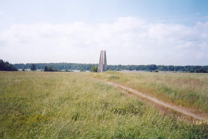
Vuosalmi was a big village on the Northern shore of lake Vuoksi. During bloody battles during March of 1940 and July of 1944 the village was completely destroyed, and now only meadows, black currant and dogrose bushes on the forest edges and basements of Finnish farms with a lot of agricultural mechanisms lying around them are saying to attentive eye that only 70 years ago these wastened fields and forgotten roads were full of life. And it's more easy to find the traces of the war. Shell craters are everywhere. Trenches and foxholes in the forest are full of cartridges and cartridge cases. And the great monument on the Soviet bridgehead is clearly seen from several kilometers across the fields...
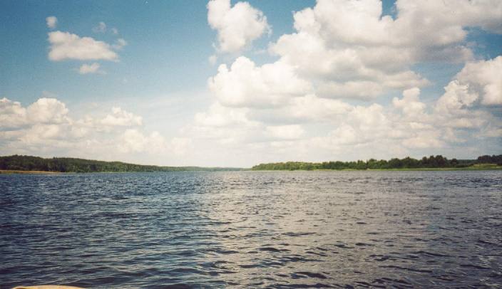
Vuoksi river in one of its narrowest places (looking in the opposite to the stream direction). It is only 300-400 meters wide here, and about 1km down the stream it turns into the lake Vuoksi which is more than 2km wide. It is one of the best places for making a bridgehead, especially for Soviets - the Southern shore (on the left) is covered by forest and a ridge along the bank so it is possible to gather a lot of troops hidden from the other side. And the Northern shore (on the right) is flat, has wide open space which is hard to defend with a narrow line of bushes on the bank which could cover the reinforcement going to the bridgehead, and this area is favorable for using the tanks.
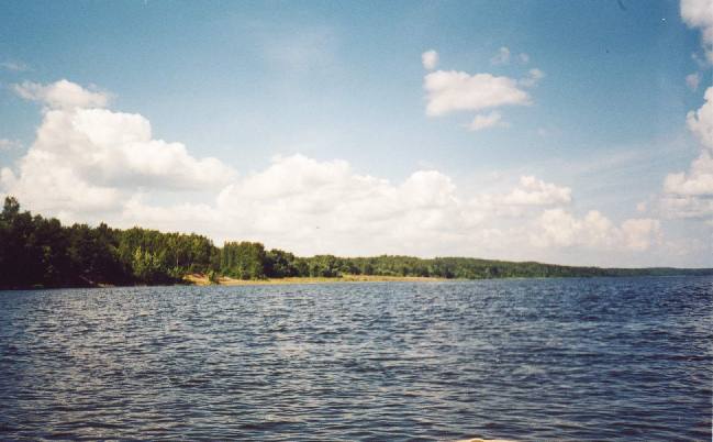
The start of the former moto-ferry line which was used by troops of Soviet 10th Rifle Division as one of the ways to cross Vuoksi. It is easy to imagine Soviet soldiers appearing from behind the Äyräpää ridge on the left, flying down to the water and crossing the river which water is boiling with bullet splashs and shell explosions.
The look from the Northern shore of Vuoksi river (from the crossroads of the main Oravankytö-Antrea road along which Vuosalmi village was situated, and the road to Niemelä farm house on the bank of Vuoksi (this road you can see in the photo) from the area of Juvonen farmhouse). Note the heights of Äyräpään harju (Äyräpää ridge) on the Southern shore. In the middle is the monument in the memory of Soviet soldiers and close to it is an apple tree on the place where the Politruk of 142nd Rifle Div fell. (It is interesting which ill fortune had brought the Politruk from 142nd RD to the area of 10th RD's assault.)
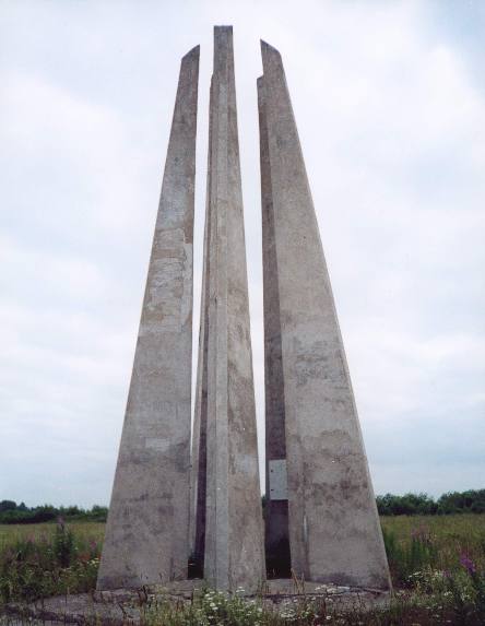
The monument in memory of fallen Soviet soldiers. It is known as "4 bayonets". Note the beginning of the forest behind the monument. In this forests Finns had stopped the Soviet assault.
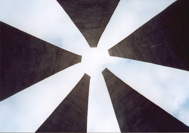
Look to the hot Karelian summer sky through the monument. It looks both peaceful and ominous. (Note that there is 5 "bayonets", not 4.)